The PIM project will deliver an open data model that defines how information is structured for precinct-scale digital modelling across the breadth of the CRCLCL initiatives. This will facilitate the delivery of accurate, timely, consistent and relevant information to inform decision making throughout the lifecycle of an urban precinct. The beneficiaries of this work range from an urban designer/planner wishing to measure projected carbon costs during precinct planning, a utility company endeavouring to optimise their operations to reduce carbon impact, a manufacturer managing the carbon efficiency of their building product or a householder seeking to understand the carbon impact of their decisions.
A Precinct Information Model (PIM) is a comprehensive 3D digital database model of a precinct that contains all the Information needed to support planning, design, development, construction, management, operation, use and retro-fitting of urban precincts.
The CRCLCL's focus is directed towards minimisation of carbon throughout the precinct life cycle, supported by a PIM. In a broader context, a PIM could be used for a whole range of other purposes.
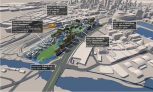
Since the physical world is made up of objects, generally constructed or adapted by us for our convenience, it is natural to construct a PIM as a collection of objects (building, bridge, road, park, etc.) and then associate data or information with those objects. Importantly, that data could be drawn from all kinds of existing sources through live database links: usage data, planning data, utility data, social data, product performance data, etc.
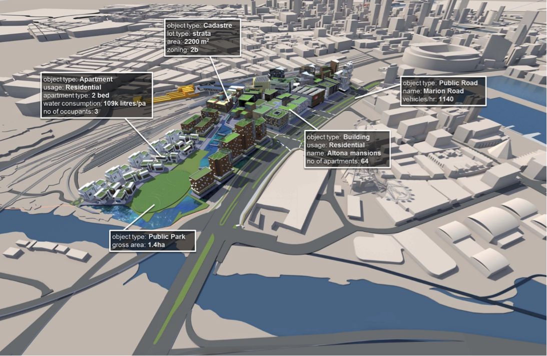
Note that many of those objects can be broken down as an aggregation of smaller objects, so a road is made up of footpaths, kerbs, gutters, traffic lanes, and those objects can be further broken down into the parts that are used to construct them (materials and structures). Furthermore, a road is actually part of a larger network of roads forming a transport system, which in itself is an object.
So, how do we identify all the objects that need to be represented in a PIM? The simple answer is that we listen to the terms used by experts when talking about precincts from their particular disciplinary perspective.
Although this can lead to ambiguity, at the end of the day they are all talking about the same things (the physical objects that make up the precinct), albeit at a different scale or degree of granularity or from a distinct disciplinary perspective. We refer to those as “model views”: different people at different times view the precinct in different ways depending on their purpose or motivations.
The research challenge of the PIM project is to explore all these different views of a precinct and develop a comprehensive digital model that accurately captures all the information needed to support all those different views of the precinct, and all the activities undertaken to deliver a low carbon built environment (whether we start with a greenfield, brownfield or greyfield, or are simply retrofitting an existing precinct to reduce its carbon load).
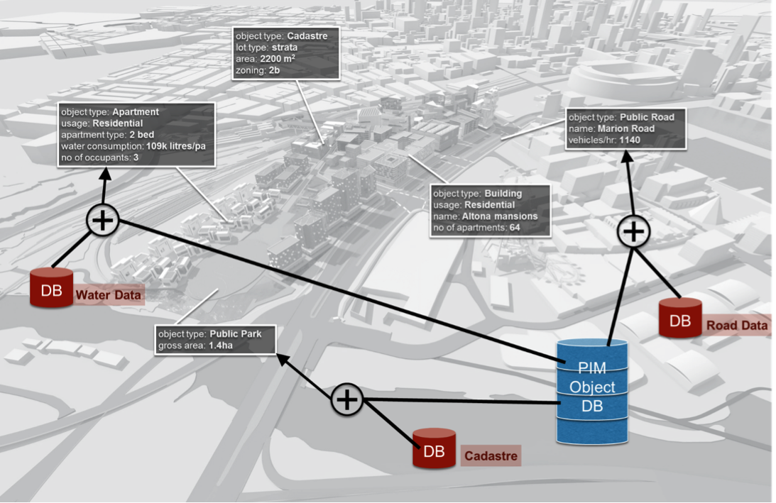
How is all this data brought together? The core PIM model is held in a PIM object database, which in turn links to many other sources of data to deliver the specific information required for a particular view of the precinct.
There are a set of technology tools and techniques that can be used to construct PIM models, generally related to database systems, web-based communication methods and process modelling approaches. The PIM research team has all those resources and is skilled at deploying them to deliver PIMs. In general, the professional activity used to deploy those technologies and techniques is known as information modelling.
It is critical to note that most of the activities described above that are supported by a PIM are carried out using computer applications. Many of those are proprietary software tools that already exist, or may be new software tools or techniques that are developed by the CRCLCL. In all cases, those applications make use of information contained in the PIM, but generally based on a very specific “model view”.
That leads to a core aim of the PIM Project: we want to define the core PIM based on a common agreed standard that supports all the required model views so that the same precinct information can be shared effectively across all those activities without duplication of effort or loss of information integrity. That is the core research challenge in the PIM project.
Importantly, the PIM becomes a vehicle for connecting all the disparate datasets that are required to deliver a low carbon built environment.